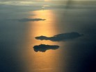
Ko Samui island of Surat Thani Province (or Koh Samui), or often, simply Samui as it is referred to by locals, is an island off the east coast of the Kra Isthmus in Thailand, close to the mainland Surat Thani town. It is Thailand’s third largest island, with an area of 228.7 km² and a population of over 50,000 (2008). It is rich with natural resources, white sandy beaches, coral reefs and coconut trees.
The island was probably first inhabited about 15 centuries ago, settled by fishermen from the Malay Peninsula and Southern China. It appears on Chinese maps dating back to 1687, under the name Pulo Cornam. The name Samui is mysterious in itself. Perhaps it is an extension of the name of one of the native trees, mui, or from the Chinese word Saboey, meaning “safe haven”. Ko is the Thai word for “island.”
Until the late 20th century, Ko Samui was an isolated self-sufficient community, having little connection with the mainland of Thailand. The island was even without roads until the early 1970s, and the 15 km journey from one side of the island to the other involved a whole-day trek through the mountainous central jungles.


